Star Map by Johann Elert Bode – Plate X
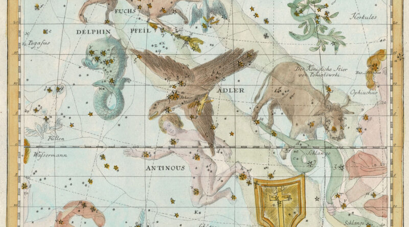
Plate X Star Map from Johann Elert Bode – Constellations shown: Delphinus – the Dolphin, Vulpecula – the Fox, Aquila

Plate X Star Map from Johann Elert Bode – Constellations shown: Delphinus – the Dolphin, Vulpecula – the Fox, Aquila
Plate VII Star Map from Johann Elert Bode – Constellations shown: Coma Berenices, or Berenice’s Hair, is a constellation in the northern
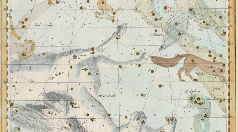
Plate XII – A Star Map by Johann Elert Bode showing the constellations Pegasus, Andromeda, Delphinus (the dolphin), Vulpecula (the
Plate XXIII – Cetus the Sea Monster. In English this constellation is also sometimes called the Whale.
Plate XXVI from Johann Elert Bode’s Vorstellung der Gestirne showing Hydra the Water Snake, the largest of all 88 constellations,
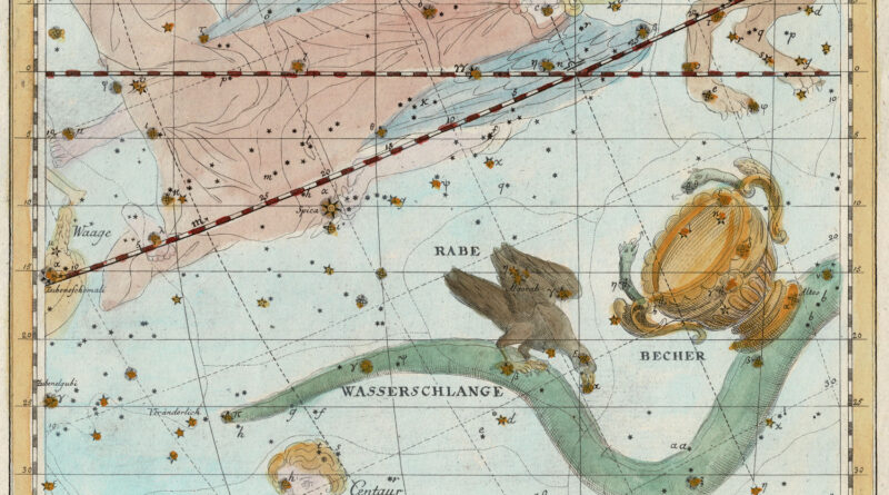
Map of the Constellations by Johann Elert Bode – Plate XXVII showing Jungfrau (Virgo), the head of Centaur, the tail end of Hydra the Water Snake, and Corvus the Crow.
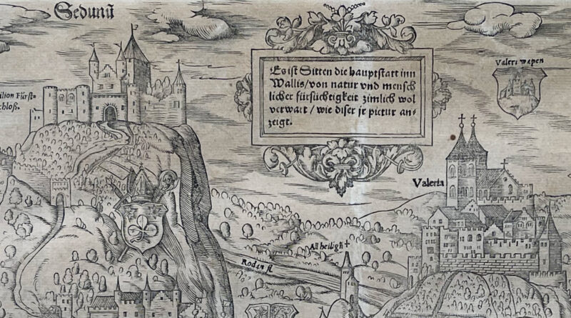
Beautiful 16th Century woodblock engraving of Sion (Sitten), Switzerland from Sebastian Münster’s famous work Cosmographia, the first German description of the world.
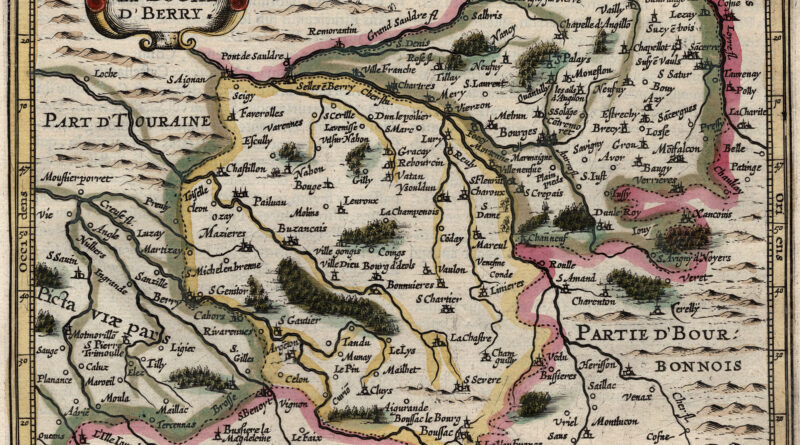
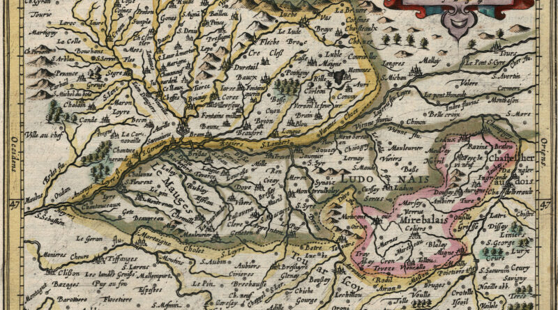
Le Duche d’Berry – Le duché de Berry – Antique map from the Jansson / Mercator Atlas Minor showing the area around the city of Bourges.
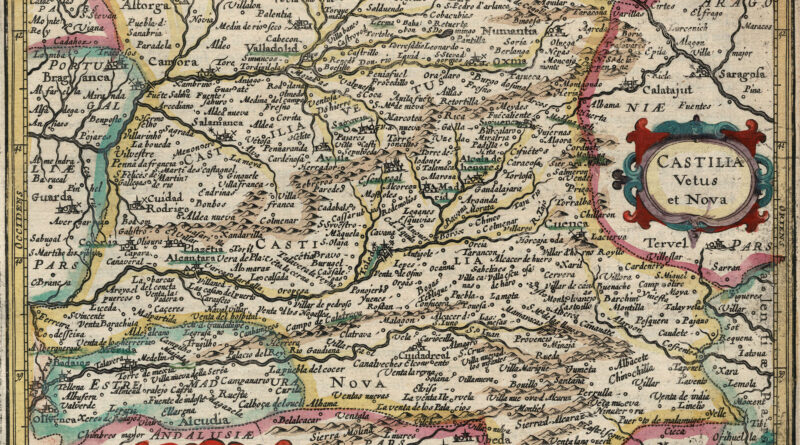
Attractive map of Castile with the city of Toledo in the center also showing Madrid, Salamanca, Valladolid etc. with decorative
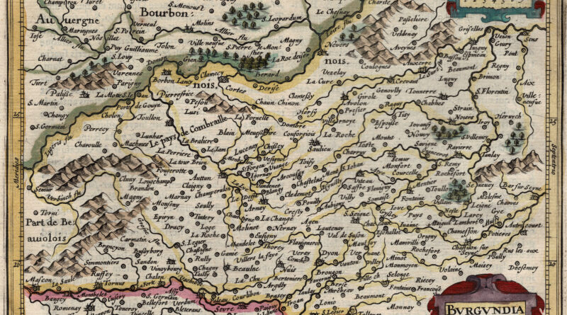
Antique map of Burgundy including Dijon, Beaune, Vezalay, Autun and many other cities of the famous wine regions.
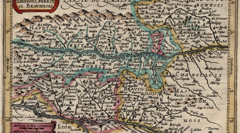
Antique map from the Jansson / Mercator Atlas Minor showing the regions of Beaujolais and Charolais.
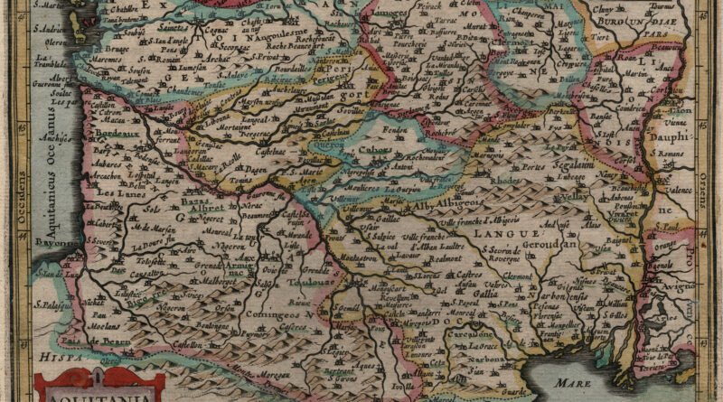
Antique map from the Jansson / Mercator Atlas Minor showing area of France formerly known as Aquitania or the Aquitaine. The area includes the cities of Bordeaux, Pau, Merignac, Pessac, Bayonne, Perigueux and much more.
Antique map of the region around Angers France from the Jansson Mercator Atlas Minor.
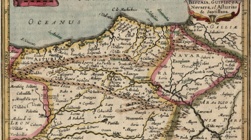
Biscay – Antique Map from Jansson Mercator Atlas Minor Copperplate engraving of the Northern Atlantic coast of Spain from Atlas
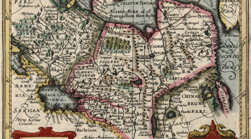
Antique Map of “Tatary” – Central and North Asia – from the Jansson Mercator Atlas Minor TATARIA – Copperplate engraving
Beautiful hand colored 1628 antique map of Scotland from the Jansson Mercator Atlas Minor.
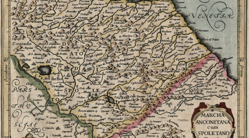
Anconitana Marchia cum Spoletano Ducatu- Copperplate engraving from Atlas Minor published by Jan Jansson in Amsterdam during the first part of the 17th Century.
17th Century city view of Geneva on Lac Leman in Switzerland – original antique copperplate print circa 1640. Elegantly framed
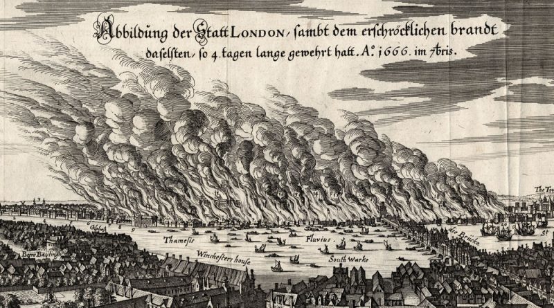
The Great Fire of London, 1666 by Mattheaus Merian circa 1670 Rare and original 17th century copperplate engraving “ABBILDUNG DER STATT
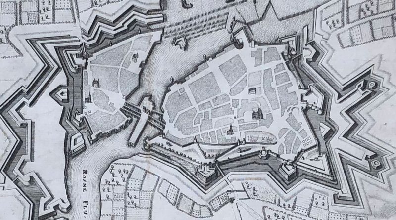
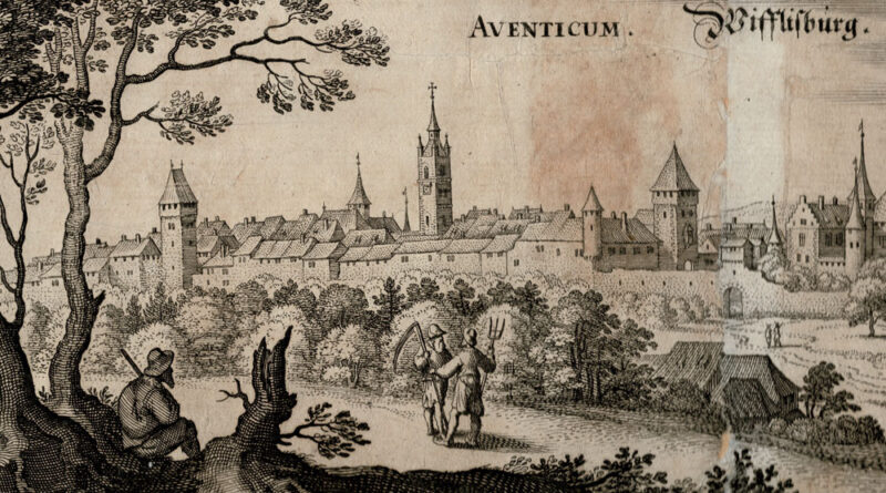
Nyon, Murten and Avenches in the 17th Century Copperplate Engraving by Matthaus Merian the Elder from Topographia Helvetiae, Rhaetiae et
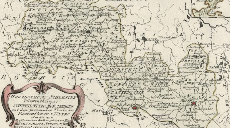
Herzogthums Schlesien Fuerstenthuemer Schweidnitz u. Muensterberg mit dem preussischen Theil des Fuerstenthums Neyss Circa 1800 map of the Schlesien or