Circa 1800 Map of Trentino and Southern Tirol by Joseph von Reilly
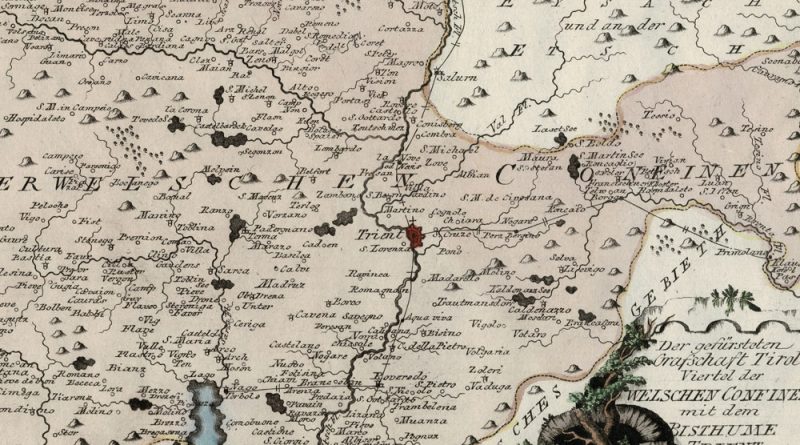
Der gefürsteten Grafschaft Tirol Viertel der welschen Confinen mit dem Bisthume Trient Circa 1800 map of the Italian Tirol and

Der gefürsteten Grafschaft Tirol Viertel der welschen Confinen mit dem Bisthume Trient Circa 1800 map of the Italian Tirol and
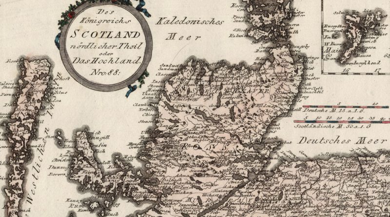
Des Koenigreichs Scotland nordlicher Theil oder Das Hochland Nro 88 Circa 1800 map of northern Scotland, the highlands, with wonderful
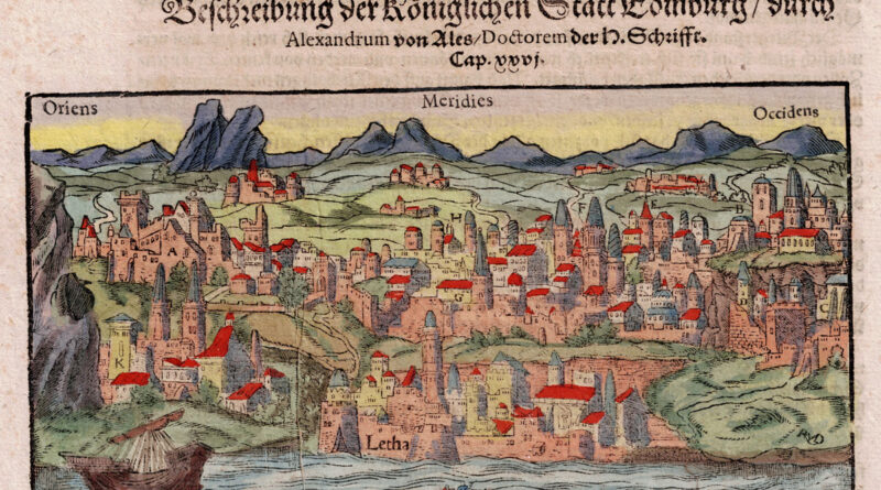
Edinburgh – Cosmographia Very interesting woodblock sheet from the 1570 German edition of Sebastian Muenster’s Cosmographie shows images of Edinburgh,
1620 Map of Northern Ireland – Ultonia Conatia, et Media Copperplate engraving by Peter Kaerius (P.Van Den Keere, 1571-1646). Beautiful
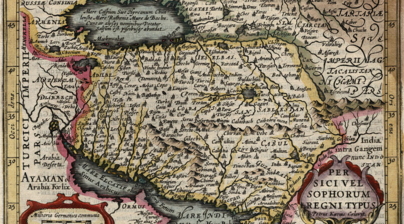
Antique map of the Kingdom of Persia from Jan Jansson’s version of the Mercator Atlas Minor.
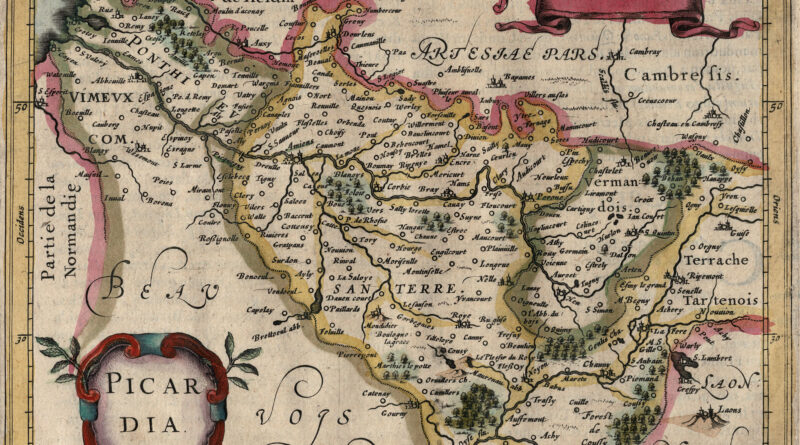
Elegant small antique map of Picardy / Picardie / Picardia – modern day Hauts-de-France – from the 17th Century Jansson Mercator Atlas Minor.
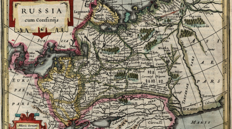
Elegant antique map of Russia from the Jansson Mercator Atlas Minor.
Comitatus Hannonia – The Belgian province Hainaut or Henegouwen Decorative copperplate engraving by Abraham Goos, Amsterdam 12 x 17,5 cm.
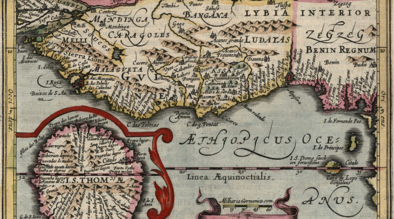
Elegant small 17th Century Map of Guinea from the Jan Jansson edition of Mercator’s Atlas Minor.
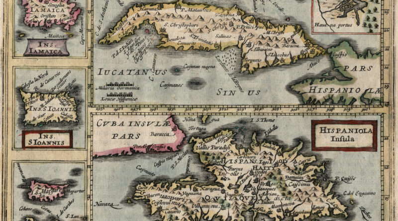
Rare and unique antique map of the Caribbean islands including Cuba, Haiti, Puerto Rico, the Dominican Republic, Margarita Island and Jamaica from the Jan Jansson edition of Mercator’s Atlas Minor. The map includes an usual publishing error – it was accidentally titled as “Island of Ceylon.”
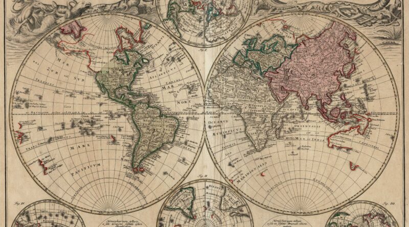
Planiglobii Terrestris mappa universalis … / Mappe-Monde qui Represente les deux hemispheres…. Nuremberg: Homann’s Heirs, 1746. A Double Hemisphere world map
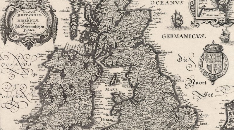
Magnae Britaniae et Hibernia – Magnae Britanniae et Hibernia 1630 Merian Map of British Isles Decorative map of the British
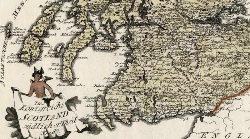
Des Koenigreichs Scotland suedlicher Theil Nro 87 Circa 1800 map of southern Scotland with wonderful detail and hand coloring.
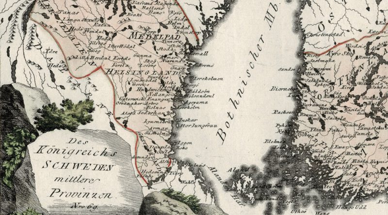
Des Koenigreichs Schweden mittlere Provinzen – Nro. 69 Circa 1800 beautifully hand-colored antique map of central Sweden by Austrian mapmaker
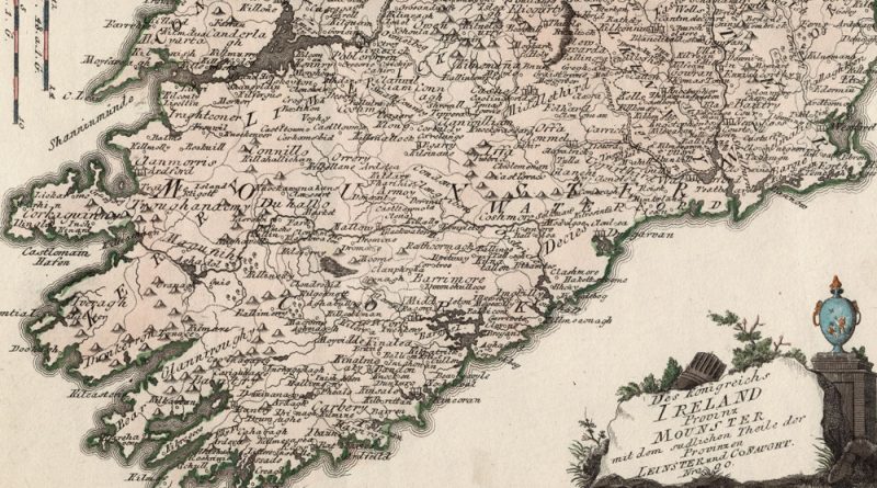
Das Koenigreich Ireland Provinz Mounster, Nro 80 Beautifully hand-colored antique map of Ireland by Joseph von Reilly. Munster, Old Irish
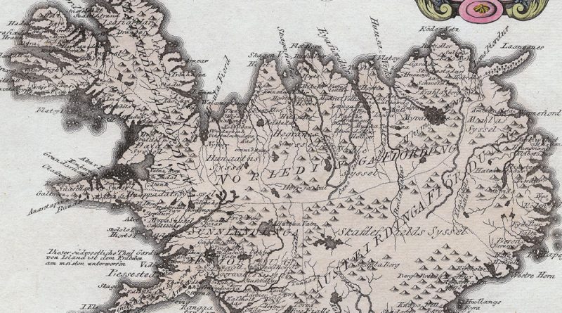
Die Insel Island Nro 76. Beautifully hand-colored antique map of Iceland by Joseph von Reilly. This finely engraved map of
Special Karte von dem Koenigreich England Nro. 79 Beautifully hand-colored antique map of England by Joseph von Reilly.
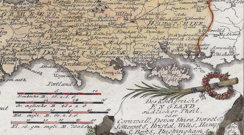
Des Koenigreichs England sudlicher Theil, oder Cornwall, Devon Shire, Dorset S. Sommerset S. Bristol, Wilt. S., Hampton S. Berkshire, Buckingham,
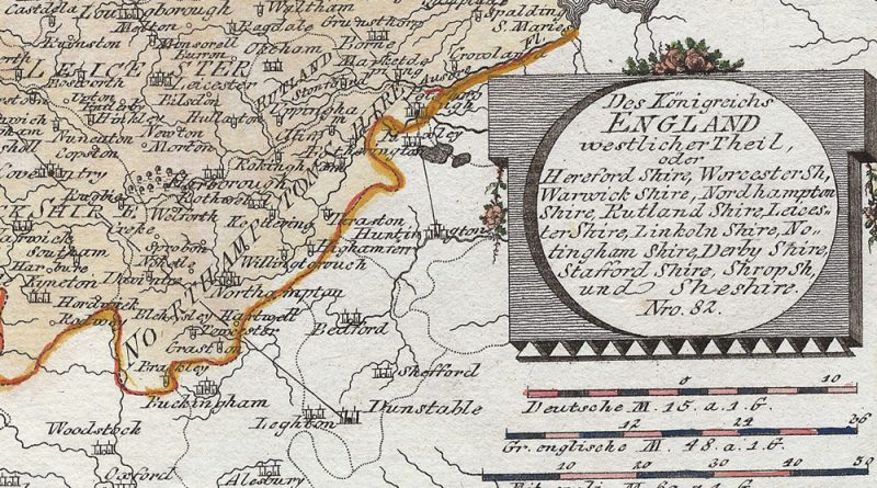
Antique Map of Western England by Joseph von Reilly showing Herfordshire, Worcestershire, Warwick, Warwickshire, Rutland, Rutland shire, Leicestershire, Lincolnshire, Nottinghamshire, Shropshire.
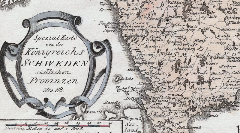
Spezial Karte von des Koenichreichs Sweden suedlichen Provinzen Nr0 68 Map of Southern Sweden By Joseph von Reilly circa 1800
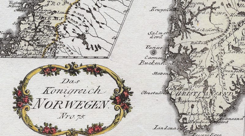
Das Koenigreich Nowegen Nro 75 Beautifully handcolored antique map by Joseph von Reilly of Norway