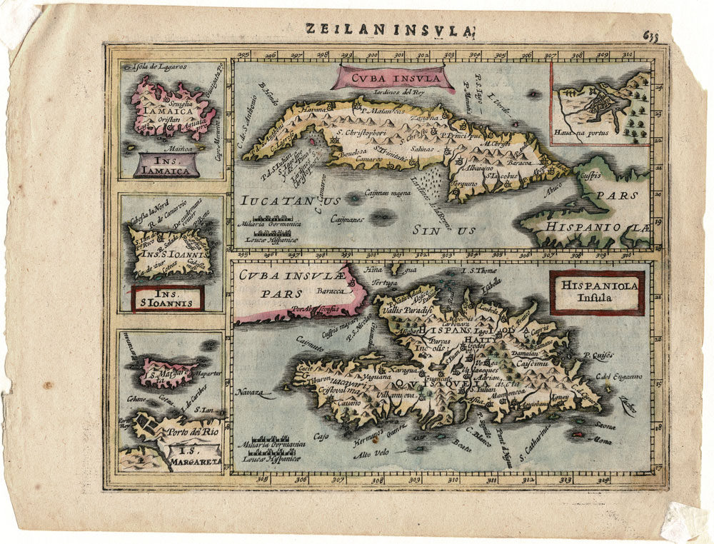
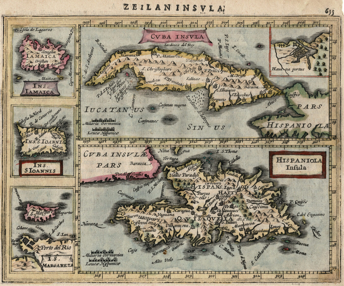
Jansson’s Atlas Minor – Antique Map of Cuba, Haiti, Puerto Rico, Dominican Republic and Margarita Island
Antique Map of Caribbean Islands: Cuba, Haiti, Dominica, Jamaica
Cuba Insula from
Jansson’s Atlas Minor
Antique map of the Caribbean Islands.
Copperplate engraving from a miniature edition of the Mercator Atlas.
The islands of Cuba and Hispaniola (Haiti, Dominica) are shown along with four insets showing the port of Havana, Jamaica, St. John and Margarita.
Five maps on one sheet: Cuba Insula — Hispaniola Insula — Ins. Iamaica — Ins. S. Ioannis — I.S. Margreta.
Copperplate engraving from Atlas Minor published by Jan Jansson in Amsterdam during the first part of the 17th Century.
Jansson’s Atlas Minor was a reduced version of the Mercator. The Copperplate engravings for Altas Minor were done by Pieter van den Keere (Petrus Kaerius – 1571-1646) or Abraham Goos.
Latin edition published in Amsterdam in 1628. Text in Latin on back of sheet.
This unusual map includes a notable error. The title above the image is”Zeilaninsula” or “Island of Ceylon” and the text on the back refers to Ceylon and not to the Caribbean islands.
Condition: Good – Light age toning. Corners are torn as shown in image of full sheet.
Sheet measures 9 X 7 inches
For comparative reference see this map in the Boston Public Library Collection.
Publisher: Jan Jansson / Johannes Janssonius / Jan Janssonius
Date of Publication: 1628
Engraver: Petrus Kaerius (Pieter van der Keere) and Abraham Goos
Dimensions: Approximately 22.5 cm x 17 cm
Jan Jansson (1588, Arnhem – buried July 11, 1664, Amsterdam) was a Dutch cartographer and publisher who lived and worked in Amsterdam in the 17th century.
He was named for his father, Jan Janszoon the Elder a publisher and bookseller in Arnhem, and married Elisabeth de Hondt, the daughter of the famous mapmaker Jodocus Hondius with whom his family had business ties. Jansson began producing maps in 1616 – and eventually owned bookstores across Europe in Frankfurt am Main, later also in Danzig, Stockholm, Copenhagen, Berlin, Königsberg, Geneva and Lyon. In the 1630s he formed a partnership with his brother in law Henricus Hondius, and together they published atlases as Mercator/Hondius/Janssonius.
Atlas Minor
Jansson’s Atlas Minor was a reduced version of the Atlas produced by Gerard Mercator (1512-1594). The Copperplate engravings for Altas Minor were done by Pieter van den Keere (Petrus Kaerius – 1571-1646) or Abraham Goos. Due to the unique error found on the map of Cuba, we believe this set of maps most likely comes from the 1628 Latin edition. Each sheet has Latin texts on the reverse.