Antique Map of Russia -Archangel – Von Reilly Circa 1800 – Nro 66
Mapmaker: Franz Joseph Johann von Reilly Russischen Reiches Statthalterschaft Archangel No. 66(German for: Russian Empire’s Governorate of Arkhangelsk No. 66)

Mapmaker: Franz Joseph Johann von Reilly Russischen Reiches Statthalterschaft Archangel No. 66(German for: Russian Empire’s Governorate of Arkhangelsk No. 66)
Mapmaker: Franz Joseph Johann von Reilly Der Russischen Reiche Statthalterschaften Pleskow, Polozk, Mohilew, Twer, Moskau, Koluga, Wolodimer, Jaroslaw, Tula, Smolensko,
Mapmaker: Franz Joseph Johann von Reilly Der untere Theil der zu Preussen gehörigen Herzogthums Pommerellen mit dem No. 3. NETZLANDE
Mapmaker: Franz Joseph Johann von Reilly Die gefürsteten Grafschafften Görz u. Gradisca mit der Hauptmannschaft Tolmino(The Princely Counties of Gorizia
Mapmaker: Franz Joseph Johann von Reilly Unter Krain No. 142 General Description:This historical map depicts Unter Krain (Lower Carniola), a
Franz Joseph von Reilly Das Herzogthum Krain (The Duchy of Carniola) This historical map shows the Herzogtum Krain (Duchy of
Franz Joseph von Reilly Das Herzogthum KURLAND und SEMGALLEN Description of Region Covered:This map focuses on the Duchy of Courland
Franz Joseph Johann von Reilly Inner Krain mit der windischen Mark und dem Triester Gebiethe(Inner Carniola with the Windic March
Title: Das Koenigreich Preussen mit den freien Staedten Danzig U. Thorn Nro 51 Elegant 1790-1800 antique map of northern Prussia.
Title: Die Koenigliche Preussen ostsudedlicher Theil Nro 52 Elegant 1790-1800 antique map of South Eastern Prussia. The map is centered
Title: General Karte von dem Russischen Reiche in Europa Nro 60. Circa 1790 – 1800 antique map by Joseph von
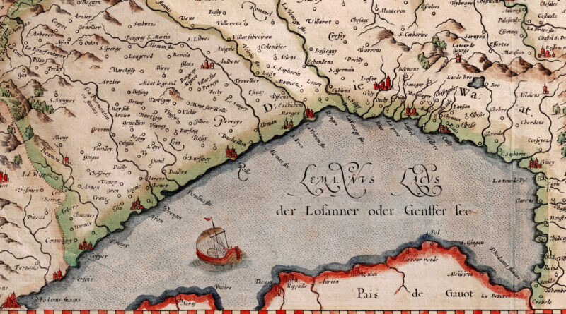
Copperplate engraving by Gerard Mercator (1512-1594) Amsterdam, Circa 1607 Renaissance title cartouche Verso: Text in French Wiflisburg was an early
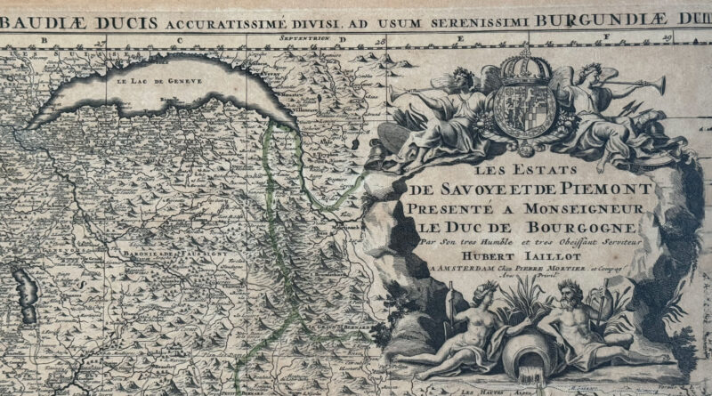
Les Estats De Savoye Et De Piemont Presente A Monseigneur Le Duc De Bourgogne; Status Sabaudiae Ducis Accuratissime Divisi, ad
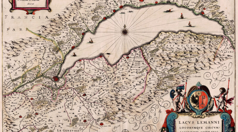
Lake Geneva 1638 by Jan Jansson based on the work of Jacques Goulart, a Swiss cartographer born in Geneva, who
Fascinating 16th Century woodcut illustrating the course of the Rhone river flowing through the Valais from “Universelle, livre III /
Marchionatus Moraviae Circulus Olomucensis … quem … exhibet Jo. Chr. Müller … Editore Joh. Baptista Homann – Circuli Olomucensis Pars
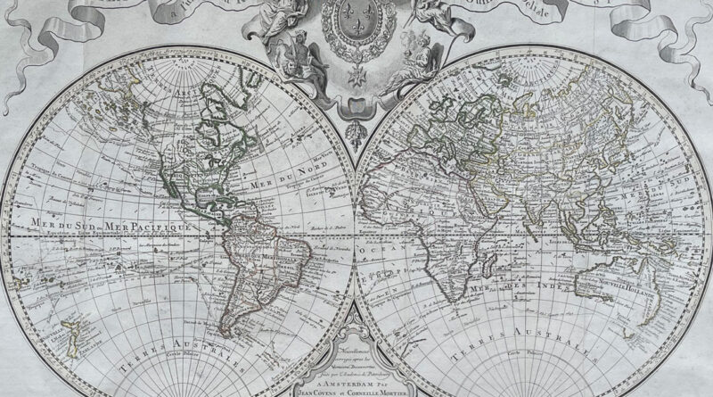
The Amsterdam edition of the 1725 World Map by Guillaume Delisle published by Covens and Mortier some years after Delisle’s
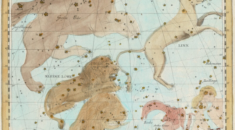
Plate V – Constellations Ursa Major, Lyncis (the Lynx), Leo (the lion), Leo Minor (the smaller lion), Cancer (the crab),
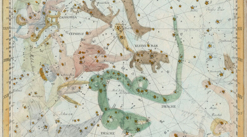
Plate II from Johann Elert Bode’s Atlas of the Stars showing the constellations Cepheus, Cassiopeia, Ursa Minor (the little bear),
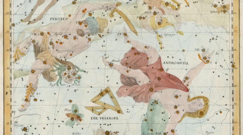
Plate III from Johann Elert Bode’s Atlas of the Stars showing the constellations Andromeda, Perseus, Triangulum.
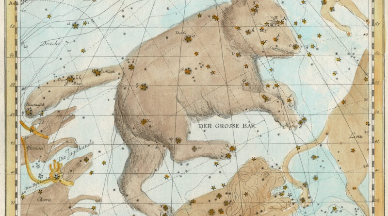
Plate VI – Ursa Major – the great bear, Leo Minor – the smaller bear, Canes Venatici -the hunting dogs.