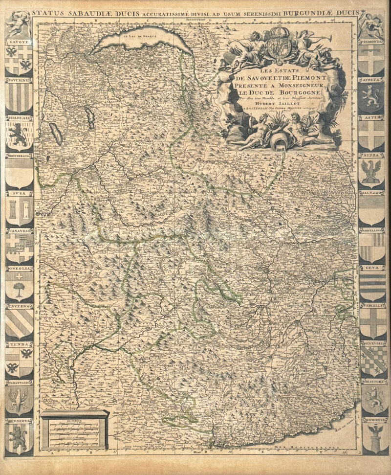
Hubert Jaillot 1705 Map of France, Switzerland and Italy – Les Estats de Savoye et de Piemont
Les Estats De Savoye Et De Piemont Presente A Monseigneur Le Duc De Bourgogne; Status Sabaudiae Ducis Accuratissime Divisi, ad usum Serenissimi Burgundiae Ducis.
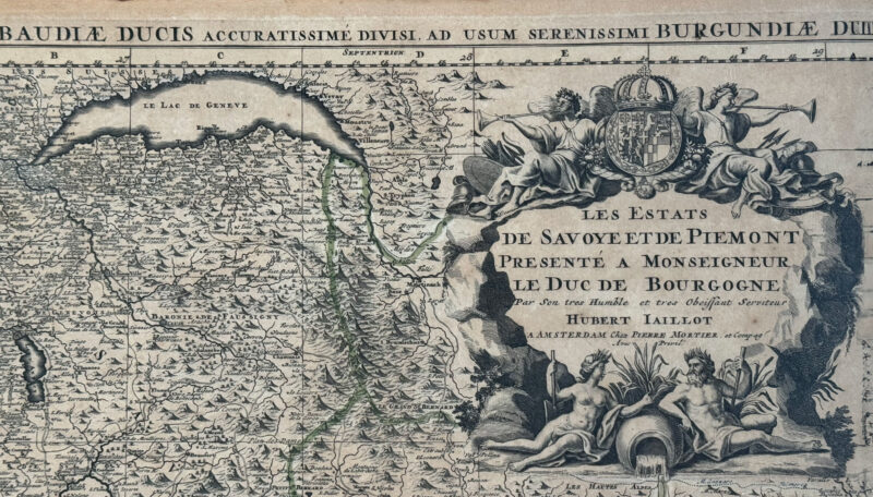
This circa 1705 map by Hubert Jaillot dedicted to the Duke of Burgundy focuses on the eastern Alps along the borders between France, Italy and Switzerland. The map extends from Lake Geneva in the north south to Nice, in the West to Grenoble and in the East to Casale. The map is surrounded by the coats of arms of the 22 provinces of the states of Savoy. Mount Blanc – Le Massif du Mont Blanc is identified on the map by the place name “Les glacieres – Mont Maudite.” In the upper right hand corner is an elegant cartouche born by four figures with the crown and collier de l’annonciade.
Dimensions: Size : 63 x 52 cm (not including frame)
Sold unframed if shipping required.