Circa 1800 Map of Trentino and Southern Tirol by Joseph von Reilly
Herzogthums Schlesien Fuerstenthuemer Schweidnitz u. Muensterberg mit dem preussischen Theil des Fuerstenthums Neyss Circa 1800 map of the Schlesien or

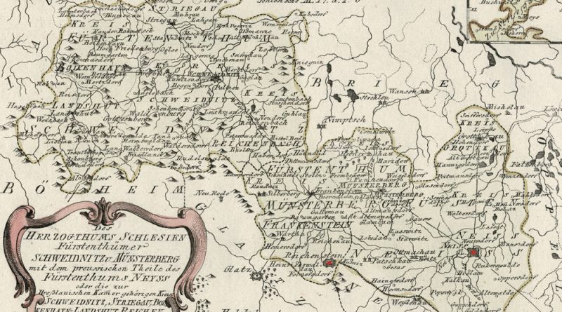
Herzogthums Schlesien Fuerstenthuemer Schweidnitz u. Muensterberg mit dem preussischen Theil des Fuerstenthums Neyss Circa 1800 map of the Schlesien or
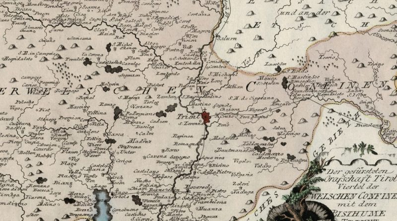
Der gefürsteten Grafschaft Tirol Viertel der welschen Confinen mit dem Bisthume Trient Circa 1800 map of the Italian Tirol and
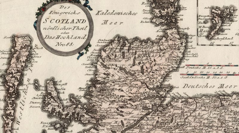
Des Koenigreichs Scotland nordlicher Theil oder Das Hochland Nro 88 Circa 1800 map of northern Scotland, the highlands, with wonderful
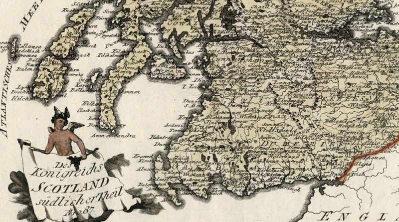
Des Koenigreichs Scotland suedlicher Theil Nro 87 Circa 1800 map of southern Scotland with wonderful detail and hand coloring.
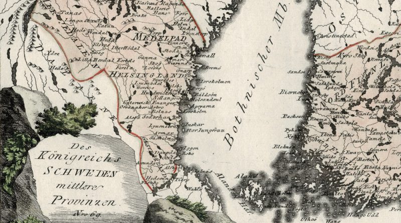
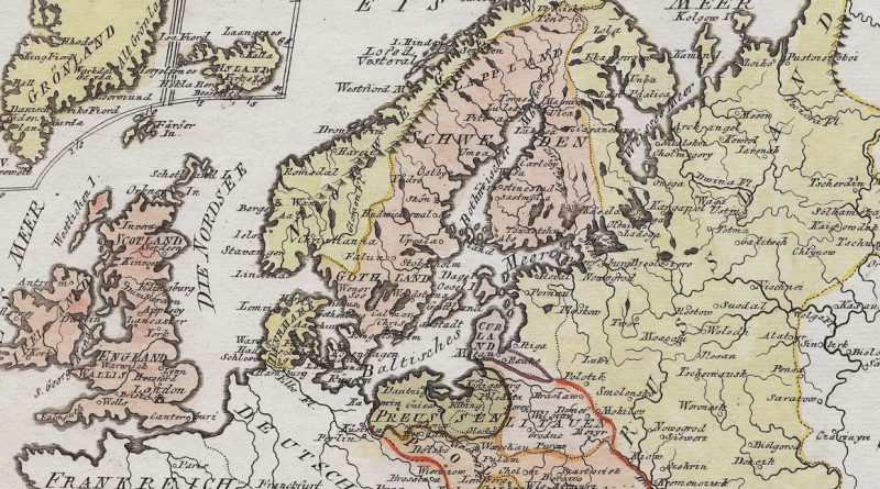
Des Koenigreichs Schweden mittlere Provinzen – Nro. 69 Circa 1800 beautifully hand-colored antique map of central Sweden by Austrian mapmaker
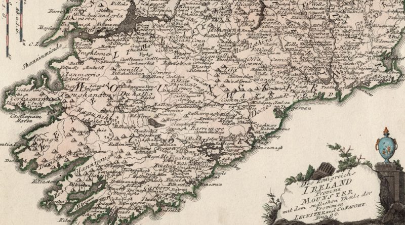
Das Koenigreich Ireland Provinz Mounster, Nro 80 Beautifully hand-colored antique map of Ireland by Joseph von Reilly. Munster, Old Irish
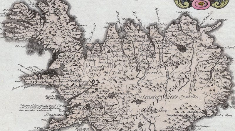
Die Insel Island Nro 76. Beautifully hand-colored antique map of Iceland by Joseph von Reilly.

Special Karte von dem Koenigreich England Nro. 79 Beautifully hand-colored antique map of England by Joseph von Reilly.
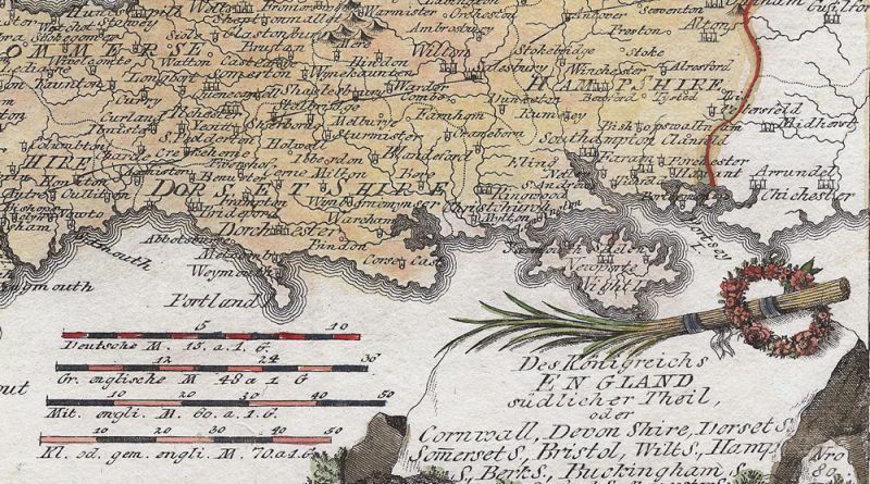
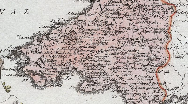
Des Koenigreichs England sudlicher Theil, oder Cornwall, Devon Shire, Dorset S. Sommerset S. Bristol, Wilt. S., Hampton S. Berkshire, Buckingham,
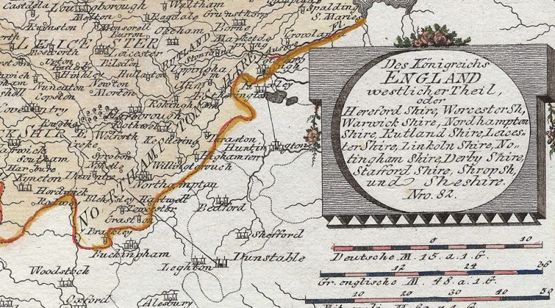
Antique Map of Western England by Joseph von Reilly showing Herfordshire, Worcestershire, Warwick, Warwickshire, Rutland, Rutland shire, Leicestershire, Lincolnshire, Nottinghamshire, Shropshire.
General Karte von Grossbritannien und Ireland Nro 78 Beautifully handcolored antique map by Joseph von Reilly showing the British Isles.
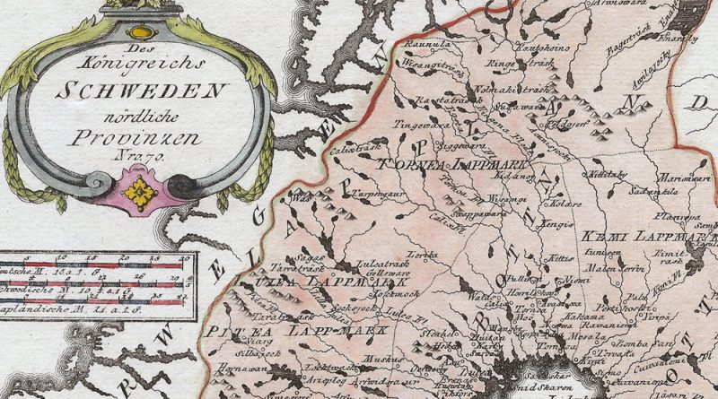
Des Koenigreichs Schweden noerdliche Provinzen – Nro. 70 Circa 1800 beautifully handcolored antique map of the north of Sweden by
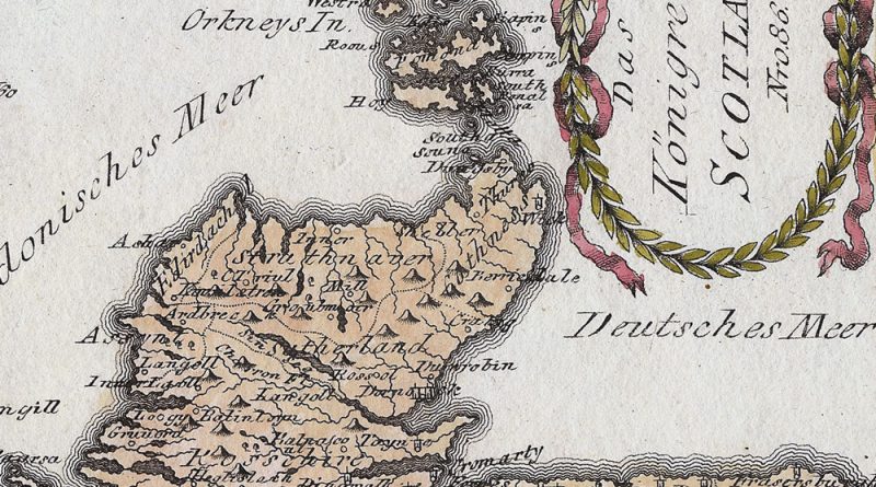
Das Koenigreich Scotland Nr 86 Circa 1800 map of Scotland with wonderful detail and hand coloring.
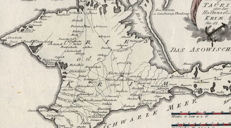
Spezial Karte von dem Koenigreich Taurien oder der Halbinsel Krim Nro 61. Elegant antique map of the Crimean Peninsula by
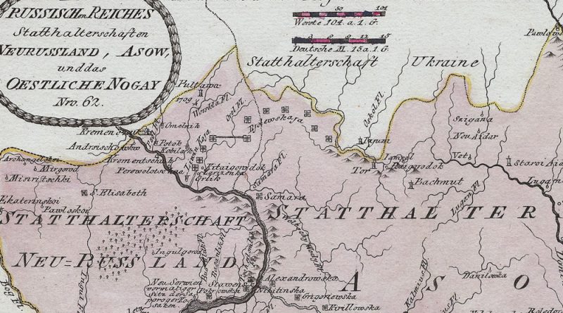
Title: Des Reussischen Reiches Statthaltenschaft en Neurussland, Asow, und das Oestliche Nogay, Nro 62. Circa 1800 antique map by Joseph
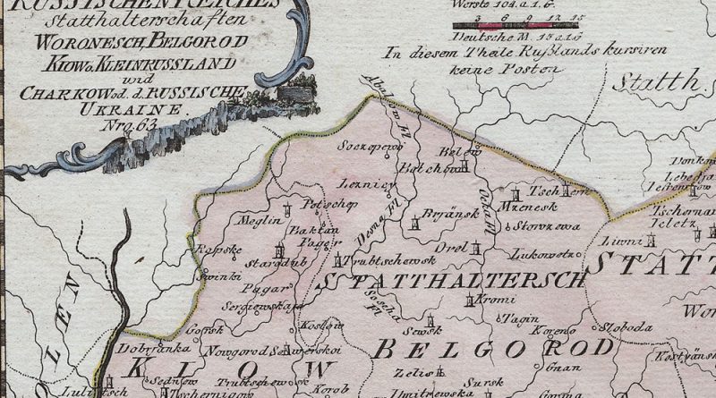
Des Russischen Reiches Statthalterschaften Woronesch Belgorod, Kiow, Kleinrussland und Charkow od. d. Russische Ukraine No. 63 Early 19th Century map
Map Maker: Franz Johann Joseph von Reilly (1766 – 1820) From: “Schauplatz der fünf Theile der Welt” Country / Region:
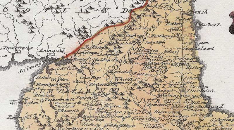
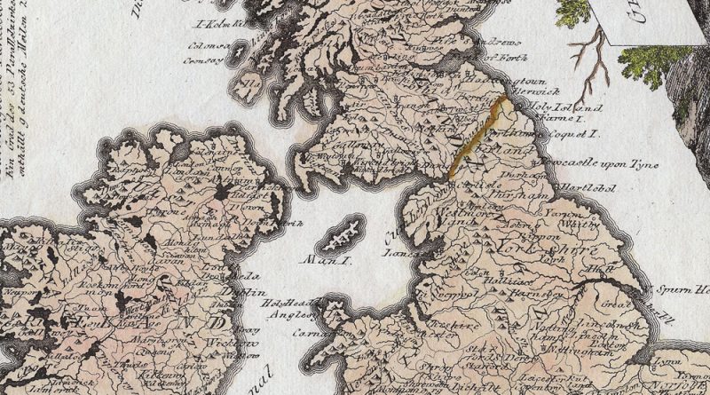
Title: Königreichs England nördlicher Theil, oder York Shire, das Bisthum Durham, Northumberland, Cumberland, Westmoreland, und Lancashire by Franz Johann Joseph