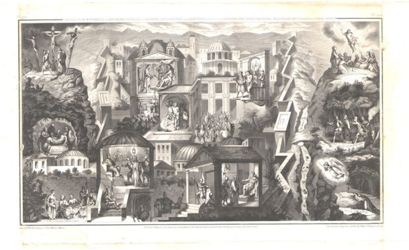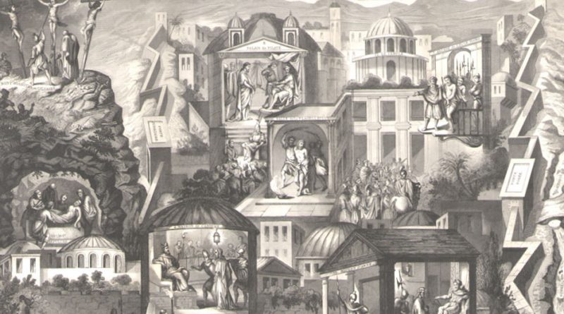
The Holy Sites of Jerusalem as Mapped by Pere Adrien Parvilliers
Holy Sites of Jerusalem – Map of the 12 Holy Sites of Jerusalem
Late 18th or early 19th Century Engraving
The Holy sites of Jerusalem as mapped by as identified by the Jesuit priest Pere Adrien Parvilliers, Apostilic Missionary of the Holy Land (1619-1678). Perhaps an early version of the stations of the cross (today there are considered to be 14 stations – this image shows 12 locations)
“Nouveau Plan Monumantal de Jerusalem Contenant les Principaux Lieux Sanctifiers par la Presence de N.S. J.C. – Par le Reverend Pere Adrien Parvilliers, Missionaire Apostolique de la Terre Saint”
Plate 900
paris Le Jeune Editeur 13, Rue Maitre Albert, Imprime par Geny-Gros, Rue du Platre, St. Jacques a Paris.
Sites Listed:
1. Grotte de L’agonie (Christ’s anguish in Gethsemane)
2. Ou Jesus eut Pris (where Jesus was taken)
3. Maison d’anne
4. Maison de Cahiphe
5. Ou St. Pierre Renia Jesus
6. Salle de la Flagellation
7. Arcade de L’Ecce Homo
8 Palais de Pilate (Pontus Pilates palace)
9. Mont Golgotha ou Calvaire
10. Sepulchre
11. La Montagne des Oliviers (the Mount of Olives)
12. Le Temple (The Temple)
Condition. The engraving has strong creases along the outer borders of the image (outside the image area), a light crease through the center, and light stains in the margins. The central image is clear and clean.